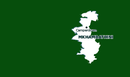
Mkhambathini Local Municipality

OVERVIEW
Contact Details

Postal: Private Bag X04, Camperdown, 3720
Physical: 18 Old Main Road, Camperdown
Tel: 031 785 9300
Fax: 031 785 2121
Web: www.mkhambathini.gov.za
Geography, History and Economy
Area: 891km²
Description: Mkhambathini Local Municipality is located along the south-eastern boundary of the uMgungundlovu District Municipality. It is the second-smallest municipality as one of seven local authorities within the district and is situated within south-west KwaZulu-Natal. Mkhambathini Local Municipality consists of seven wards, with a large part of the municipality being rural in nature and underdeveloped. Mkhambathini is an isiZulu word derived from eMkhambathini, which means ‘the place of acacia trees'. Mkhambathini has several comparative advantages. It is well located in relation to Durban and Pietermaritzburg and adjoins Cato Ridge, a potential industrial node. The N3, which is identified in the Spatial Growth and Development Strategy as a Provincial Corridor, runs east-west through the central part of the municipal area. Significant portions of the municipality fall within the Valley of a Thousand Hills (with Table Mountain a major landmark), an area with high potential for ecotourism, and in the Midlands Mist Belt, which has a well-established agricultural economy.
Cities/Towns: Camperdown
Main Economic Sectors: Agriculture, tourism


